July 22, 2022
Here are a couple of maps to give readers some guidance on where we are, especially if you are not familiar with Alaska. My blog entries won’t catch up with the maps for awhile.
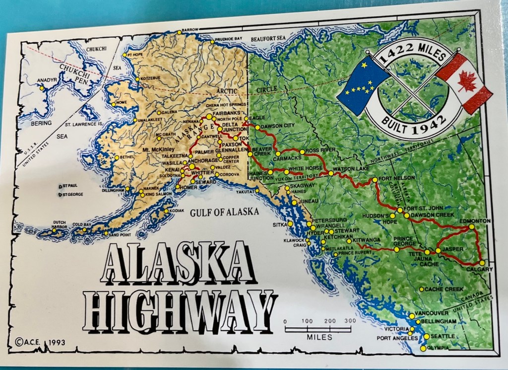
The first map is on an old postcard, and doesn’t have all the roads, but does give an overall view. We drove the loop from Edmonton to Jasper and back to Calgary, all in the Province of Edmonton, then joined up with our friends Dee and Cheryl. We went northwest from Calgary to Whitecourt, between Edmonton and Dawson City. The Alaskan Highway officially begins in Dawson City, in the province of British Columbia. We followed it through Fort St. John, Fort Nelson and the northern part of BC to Watson Lake, in the province of Yukon. We continued on the more southern route in Yukon through Whitehorse, Haines Junction and Beaver Creek. After Beaver Creek we crossed into the US, in Alaska, and went to Tok, then on to Glennallen, which was a base for nearly a week as we went to different places in the area. There is now a “Tok Cutoff” highway directly from Tok to Glennallen, and another highway from Glennallen to Palmer.
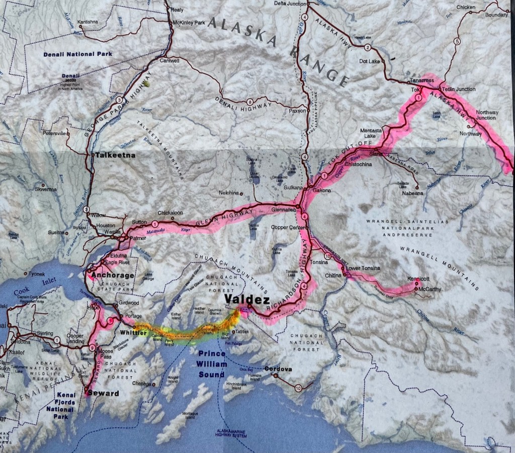
The next map shows part of southeastern Alaska, and is highlighted with some of the routes we have taken. The pink was all by Sylvee Van or in Dee’s truck. The orange green was a ferry ride we took Sylvee on from Valdez to Whittier.
There’s lots more to tell you about all our adventures, so stay tuned!

What an adventure. Thanks for sharing!
LikeLiked by 1 person